N5DUX's Satellite Guide - Gridsquares

Maidenhead Gridsquare Map
(courtesy of Icom)
(courtesy of Icom)
Gridsquares
Gridsquares, or Maidenhead Gridsquares, are a way to provide location information to other radio operators. This system is officially referred to as the Maidenhead Locator System and was developed by the IARU VHF Working Group at their meeting in Maidenhead, England (hence the name), in 1980.Gridsquares, or "grids" for short, are broadly known by a 2 letter, 2 number designator such as FN31, EM20, or CM98. Letters range from A-R, and digits from 0-9.
The Maidenhead system allows for further location within the larger gridsquare through the use of additional pairs of letters (such as FN31pr, FM20fe, or CM98it) but ham radio operators usually only use the broader 2 letter, 2 number designator when reporting a location.
Each gridsquare is 2° longitude by 1° of latitude. Smaller, "subsquares" (6 characters) are 5' of longitude by 2.5' of latitude.
The first letter is determined in increments of 20° of longitude and the second letter by increments of 10° latitude.
The globe is divided into squares (which they aren't true geometric squares) with the origin, or AA, starts at 180° W, and -90° S. (That's in Antarctica near the international date line, if you're wondering.) While RR, the final gridsquare, stops at 180°E and 90°N. (That's north of Siberia leading up to the North Pole, just west of the International Date Line; northwest of Alaska)
Importance of Brevity
Understanding the gridsquare an operator is located in is important for satellite operators because this is the location given during a contact made through a satellite. With FM satellites, the radio contact is so brief there's only enough time for an exchange of callsigns and gridsquare. It's rare to give city and state location. Linear satellite operators often have more time to exchange information, but the gridsquare is still vital information to exchange. This is important because other radio operators may be trying to log new grid squares for an award such as VUCC or Gridmaster.Gridsquares are the primary location information used for VHF/UHF and microwave contacts. It is also used in some digital modes such as FT8 which is popular on HF bands where brevity is valued.
Finding your gridsquare
It is possible to calculate your gridsquare (see below), but fortunately there are software packages that provide conversion from latitude and longitude to the corresponding gridsquare. There are free apps for smartphones that do this. Many handheld GPS devices even display Maidenhead gridsquares.As an iOS user, I use the SatSat app to track satellites. In the Settings screen it will display the current gridsquare for where the GPS locates me. (Very helpful if I'm out rovering.)
There are several websites that can help you find your gridsquare. One of my favorites is K2DSL's interactive map that draws the gridsquare on the map. (I'm sure there are countless others. Drop me a line to tell me yours!)
Calculating Gridsquare
- In order to calculate your grid, to do it numerically, we must get rid of "East" and "West" and use +180 and -180 notation and +90 and -90 in place of "North" and "South", respectively.
So the origin is now at -180° and 0°. - Negative numbers can make the algorithm messy.
Add 180 to the longitude to it positive, and 90 to the latitude to make it positive. - Divide your longitude by 20. Write down your answer, both the whole number and decimal component. (we'll need it later)
Look at just the whole number. That tells you the how many letters after A the first grid letter is. - Divide the latitude by 10. Write down your answer, both the whole number and decimal component. (we'll need it later)
Look at just the whole number. That tells you how many letters after A the second grid letter is.A B C D E F G H I J K L M N O P Q R S T U V W X 0 1 2 3 4 5 6 7 8 9 10 11 12 13 14 15 16 17 18 19 20 21 22 23 - To get the numeric designator for longitude, use the remainder of the longitude (from Step 3) and divide by 2.
Round down to the nearest whole number. The whole number is your first designator number. - To get the numeric designator for latitude, use the remainder of the latitude (from Step 4).
Round down to the nearest whole number. The whole number is your second designator number.
(Basically just drop/truncate the decimal component.)
If you want to calculate the subsquare, do the following steps:
- To find the first subsquare letter, use the decimal component of the remainder of your longitude (from Step 3) and divide by .0833. Write down your answer, both the whole number and decimal component. (we'll need it later)
Round down as before then use resulting number to find the letter in the lookup table above.
The reason for this number is because each subsquare is 5' of longitude. To determine which subsquare to use, you divide the remainder of your longitude (in °) by 5' which is .0833° (5÷60) - To find the second subsquare letter, use the decimal component remainder of the latitude (from Step 4) and divide by .0416. Write down your answer, both the whole number and decimal component. (we'll need it later)
Round down like before and use the number to find the corresponding letter from the table.
The reason for this number is because each subsquare is 2.5' of latittude. To determine which subsquare to use, you divide the remainder of your latitude (in °) by 2.5' which is .0416° (2.5÷60)
If you want to calculate the 8 character subsquare, do the following steps:
- Use the decimal component of the remainder of your longitude division from Step 7 and mulitply by 10.
Round down to the nearest whole number. The whole number is you first subsquare designator number. - Use the decimal component of the remainder of your latitude division from Step 8 and mulitply by 10.
Round down to the nearest whole number. The whole number is you second subsquare designator number.
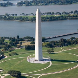
Washington Monument
(courtesy of US NPS)
(courtesy of US NPS)
Calculating an Example
The Washington Monument in Washington, DC, is located at 38.8895°N, 77.035°W
To use the algorithm above, we must first convert "West" to be negative. This gives us -77.035 for the longitude.
Next, we need to add 180 to the longitude, and 90 to the latitude.
So -77.035 + 180 = 102.965 for the longitude and 38.8895 + 90 = 128.8895 for the latitude.
The next step is to divide longitude by 20, and latitude by 10. Keep track of the remainders!
Longitude: 102.965 ÷ 20 = 5 with a remainder of 2.965
Latitude: 128.8895 ÷ 10 = 12 with a remainder of 8.88895
Using the lookup table above, the first letter, for longitude, 5 is F.
Using the lookup table again, the next letter, for latitude, 12 is M.
The final step is to divide the remainder from the longitude above by 2. 2.965 ÷ 2 = 1.4825. Rounding down, we get 1.
We round down any decimal value for the latitude which gives us 8.
So... altogether, our resulting gridsquare is FM18. Which if you look at the map above, it places most of the National Mall, the Monument included, in FM18! Great work!
To continue getting even more specific, and get the subsquare, we use those decimal values from above.
So we take the .965 part of the remainder and divide by .0833. .965 ÷ .0833 = 11.5805. Rounding down, 11.5805 becomes 11.
Using the lookup table above, the first letter, for the longitude subsquare, 11 is L.
Next we take the .8895 part of the remainder and divide by .04166. .8895 ÷ .04166 = 21.34809. Rounding down, 21.34809 becomes 21.
Using the lookup table above, the second letter, for the latitude subsquare, 21 is V.
The last part is to take the .5805 decimal from the previous step and multiply by 10. .5805 × 10 = 5.805. Rounding down, 5.8 becomes 5.
The final step is to take the .34809 from the previous step and multiply by 10. .34809 × 10 = 3.4809. Rounding down, 3.4 becomes 3.
So, taking all these bolded values and stringing them together, we get FM18LV53.
Using this gridsquare map, you can zoom in all the way on FM18LV13 and see you're right on the Washington Monument (and the WW2 Memorial just to the west)! Not too shabby!
Now try finding another famous landmark's gridsquare such as the Statue of Liberty which is located at 40.6802N,74.0445W. (remember to convert W to negative!)
When you think you have the gridsquare, mouse over the answer here: FN20XQ45
Coding it
There are hundreds of programming languages out there. Here's just one example of what the Gridsquare algorithm looks like, written in Python. There may be some efficiency/improvements that can be made, but the purpose is to be instructive.Python:
long = -77.035 //set Longitude
lat = 38.8895 //set Latitude
long = long + 180
lat = lat + 90
long_letter = int(long / 20)
lat_letter = int(lat / 10)
long_num = int((long % 20) /2)
lat_num = int(lat % 10)
gridsquare = chr(long_letter+65) //first letter
gridsquare += chr(lat_letter+65) //second letter
gridsquare += str(long_num)
gridsquare += str(lat_num)
print(gridsquare) //Output: FM18
One trick this code is doing, for those that may notice, is it is adding 65 in order to arrive at the ASCII value for that letter.
lat = 38.8895 //set Latitude
long = long + 180
lat = lat + 90
long_letter = int(long / 20)
lat_letter = int(lat / 10)
long_num = int((long % 20) /2)
lat_num = int(lat % 10)
gridsquare = chr(long_letter+65) //first letter
gridsquare += chr(lat_letter+65) //second letter
gridsquare += str(long_num)
gridsquare += str(lat_num)
print(gridsquare) //Output: FM18